


Sawyer's Rock
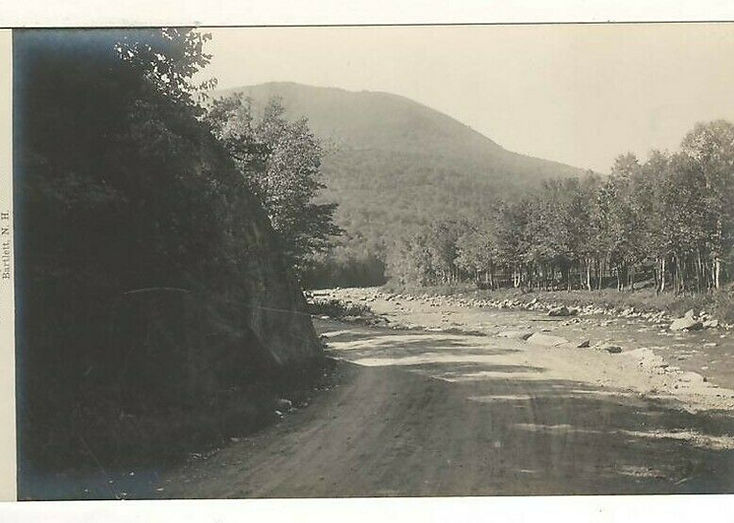
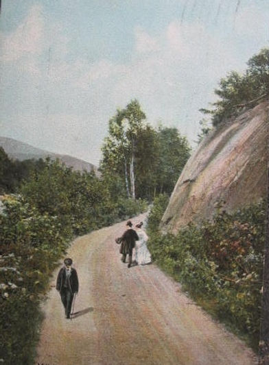
Sawyer's Rock was once a very visible landmark on Route 302 going west out of Bartlett Village. Currently, (2024) if you don't know where to look, and even if you do, there is not much left to see.
Driving past this spot today you will note that Sawyer's Rock has been nearly obliterated to make way for people who want to get where they are going a little bit faster.
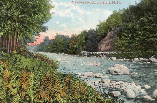

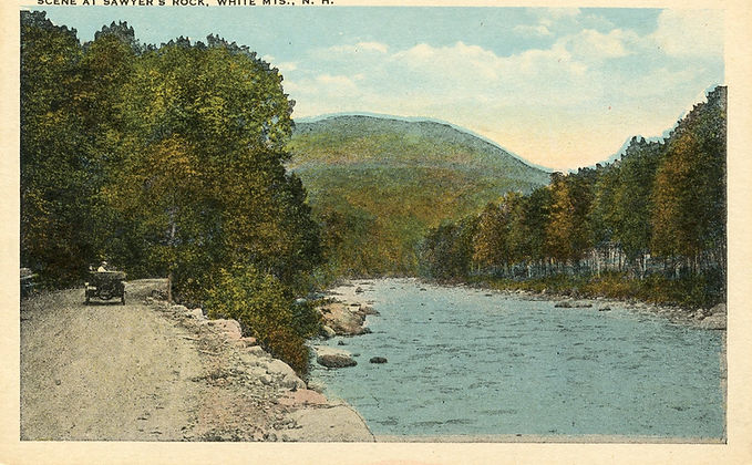
About all that is left of historic Sawyer's Rock is this little chunk of it now located in the Upper Bartlett park, which is also the site of the historic Bartlett Hotel that once occupied this site.


Rte 302 looking west. Mountain Home Cabins in the distance. Silver Spring Cottage is on the right. The Village is about a half mile in the opposite direction. Date is about 1920.

In Upper Bartlett is a neat little edifice, known as the " Chapel of the Hills," (picture below) built through the efforts of Rev. Mr. Souther among the people of the place, aided with a handsome contribution of three hundred dollars from a Mrs. Snow; who, however, died a short time before this object of her pious munificence was attained. The house was dedicated January 21, 1854, the interesting occasion calling together a large attendance, notwithstanding the deep snows of the mountain roads. Source: http://genealogytrails.com/newham/carroll/history.html

Another consideration as you try to figure out this picture: Perhaps when the picture was produced from its original negative it may have been reversed; To correct that, imagine if the chapel building appeared on the right side and the other buildings would be on the left.
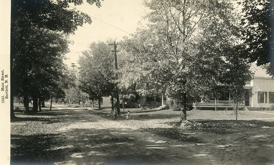
Main Street dated 1896, looking west at Mt Carrigain. That much is a definite fact. We have had some friendly debate about how the church fits into this picture. This editor has found that it was called "The Chapel of the Hills". At the time of this photo it was on the front lawn of today's school. It was later moved across the street where it remains to this day (2019) but without the Bell Tower.
About 1800 Obed Hall's Tavern was said to be in this area. Obed was one of the early prominent pioneers, arriving in Bartlett Village in 1793. His Tavern was in this area.
The large building on the right is in the area where the Cave Mountain House was located, and one of those buildings is probably it. It was built in 1890 and burned in 1905.
Source Material, "The Latchstring Was Always Out" Aileen M. Carroll - 1994 Page 12

Albany Avenue, 1920; looking north. The photographer would have been standing near the railroad tracks
Main Street 1909 - Looking West. This is the corner of Main and River Street. The horse watering trough is still there,

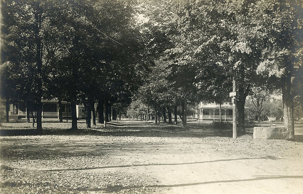
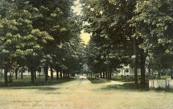
Main Street looking West
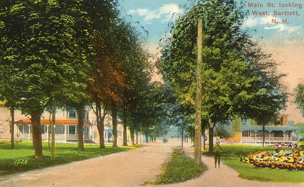
Main Street Looking West

Caption says "Main Street Looking North". I'd guess they meant "Looking West". What Not Shop and Mobil Gas on the left. The George house is on the right behind the trees, The red roof is.>>________?________

Albany Ave from Railroad Square, Congregational Church stairs visible on left, Building on right is the Post Office and the Howard Hotel. dated 1915.
Main Street 1909 - Looking West. This is the corner of Main and River Street. The horse watering trough is still there,
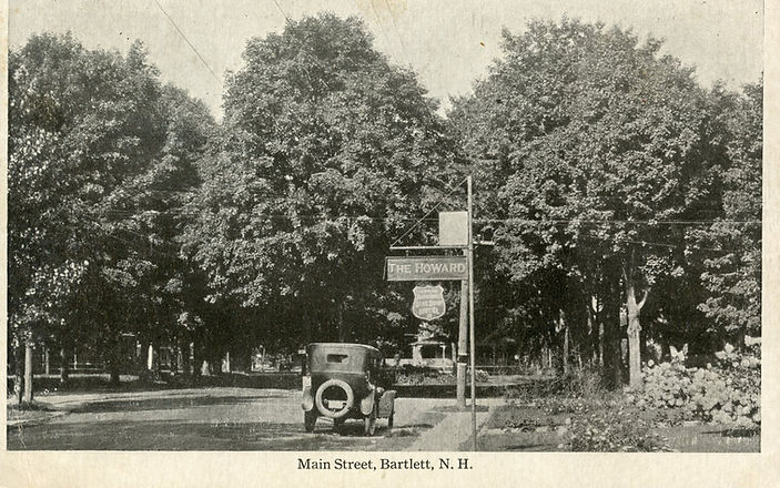
Main Street 1945 - Sign says "Howard Hotel"
Main Street near Woodbine Cottage Inn, Looking east. Who are those two young kids standing by the street? Also, note the method of hanging streetlights back then...
River Street Bridge, Dated 1909. On the larger version (click) there is a drainage pipe of some sort on the right, emptying into the river...it is still there today. What does it drain?

Route 302 looking west in the vicinity of today's North Colony Motel. Late 1940's
Concord Evening Monitor 1893 (1896)?
Fire Sunday Destroys Entire Business District in Bartlett
Total damage will approximate $100,000
At 5 o’clock a fire was discovered at rear of H. L. Towle’s grocery store and as there was no fire department in the village, it spread with lightening like rapidity.
Word was telegraphed to North Conway for aid and at 7 o’clock a special train left for the scene. The ten mile run was made in a little over ten minutes. When the special arrived the business portion of the town was in ashes.
The most strenuous efforts of the town’s people, assisted by the willing guests of the hotels availed to nothing. Within 2-½ hours but one store was left in the place. Fourteen families had been burned out and the Maine Central Railway Station, restaurant, and freight depot, together with the post office were destroyed. The total damage will be in the neighborhood of $100,000.
Following are the principal losses:
-Maine Central Railway about $10,000, insured
-Mr. & Mrs. Foster, general store, buildings, stock $25,000, insured for $7,500
-P.J. Martin, general store, $15,000, insured $9,000
-F. Garland, drugs and jewelry, $2,500, insurance $1,500
-E.O. Garland, building, contents, $15,000 insured $7,000
-J. Emery, house and furnishings, $3,000 insured $1,500
-J. Head house $1,500
-H.E. Brooks (?) grocery store, $2,500 insured $1,000
-H.L. Towle’s building, $3,000, insured $1,000
-A.L. Meserve building and stock, $6,000 insured $2,800
-Miss Emily A. Merserve tenement block, $2000, insured $1,500
-Miss Bates, millinery $500
The town has an ordinary population of 2,000 but this is swelled in summer to three or four times this number.
It is situated in the White Mountain Division of the Maine Central Railroad and the ride over this road from North
Conway through Bartlett to the Crawford Notch is one of the finest in the eastern part of the country.
-From the history files at the Bartlett Public Library

Left to Right, George Chappee, Sammy Drown (son of Myrtle Drown), Jim Clemons, Sr ; Girl in front is Ona Bond. This appears to be the late 1950's.
The location would be in front of the old Garlands Restaurant. Chippanock Inn back left, the little building next to it was moved from another location. It was the oldest building in the Village at the time. It was torn down in the early 1960's. Notice the Shell Station on the right. You can't quite see it, but Mr. Clemons has a shirt with the Shell Logo, so we could presume he worked there. That location had a Gulf Station in the mid 1960's operated by a Mr. George Flynn. Mr Flynn and his family rented the Dot Stewart house down by Sky Valley. Flynn moved to Rochester, NH in 1968 and operated a much larger Gulf Station there, right in the center of town. As to the Bartlett Gulf Station, it sat idle for a time, in the early 1970's Mr. Richard Jones operated a restaurant called Fat Cats in the same building. It only survived for a year or two. It is currently the location of the Rogerson Construction Company.
Photo courtesy of Maureen Hussey